


Tūhuratia Discoverable narrative
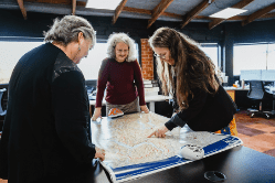
The five papatipu rūnaka (local Māori authority) from the wider Otago region, Waihao, Moeraki, Puketeraki, Ōtākou, and Hokonui have come together to set up and own Aukaha.
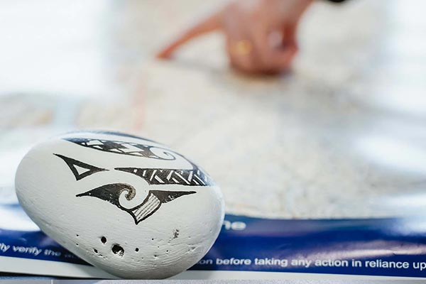
These five rūnaka all have an enduring relationship with the environment, and to represent that relationship landscape photography has been woven through the website. These images speak to the unique relationship these rūnaka have. Click to reveal the location’s story.

Māniatoto
Māniatoto is the correct spelling for Maniototo – the elevated inland region surrounded by the upper reaches of the Taiari and Manuherekia rivers. One possible explanation of the name Māniatoto relates to karaihe (Buchanan’s sedge, carex buchananii), the reddish-brown sedge that is widespread in Te Waipounamu. In certain lights, the karaihe on the plain (mānia) resembles a sea of red blood (toto). Find out more about Kāi Tahu placenames here

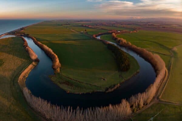
Taiari
Taiari is the correct spelling for the Taieri River located in Otago. From its source, the Taiari River flows almost entirely around Pātearoa (the Rock & Pillar Range) before discharging into Te Tai-o-Āraiteuru (the Otago coastline). The wider Taiari area is a major mahika kai resource with the coastal area, inland waterways and surrounding hills providing an abundance and variety of kai.

Wainono
Wainono Lagoon in South Canterbury is a renowned kāika mahika kai (food-gathering place). A variety of native fish including tuna (eels) and inaka (whitebait) were gathered from the lagoon and its many tributaries. For instance, 2,500 eels were harvested from Wainono and sent overseas to Māori soldiers during World War II. Large quantities of ducks, including pūtakitaki (paradise ducks), pārera (grey duck) and teal, were also harvested from the lagoon.

Kā Rā-o-Tākitimu
Kā Rā-o-Tākitimu – “The Sails of Tākitimu” –is the traditional Māori name for the Waimea Plains in Murihiku (Southland). According to tradition, the Tākitimu waka was travelling around Te Waipounamu when it was capsized by three large waves in Te Waewae Bay, forming the Takitimu Mountains. The name “Kā Rā-o-Takitimu” refers to the resemblance of the plains to the sails of the famed waka.
Find out more about Kāi Tahu placenames here https://www.kahurumanu.co.nz/atlas

Te Ahi-o-Hakitekura
Te Ahi-o-Hakitekura (Refuge Point) is a small point on the southern shore of Whakatipu Waimāori. Hakitekura, a Kāti Māmoe woman, was the first person to swim across the lake. After watching other young women attempting to outswim each other, she decided that she wanted to outdo them. Sh e got a kauati (stick used to start fire) from her father, and a bundle of dry raupō for kindling. The next morning, Hakitekura set out from Tāhuna. With the kauati and raupō bound tightly in harakeke (flax) to keep them dry, she swam across the lake in darkness, with the bundle strapped to her. When Hakitekura landed on the other side of the lake she lit a fire that blackened the rocks. This place became known as Te Ahi-a-Hakitekura, meaning “The Fire of Hakitekura”.
Find out more about Kāi Tahu placenames here https://www.kahurumanu.co.nz/atlas

Matakaea
Matakaea (Shag Point), located immediately north of the Waihemo (Shag River) on the Otago coastline, is where the famed Ārai-te-uru waka capsized. The Ārai-te-uru waka came from the ancient homeland of Hawaiki, bringing kūmara to Aotearoa. After reaching Te Ika-a-Māui (North Island), the waka then travelled down the east coast of Te Waipounamu. The journey was reasonably smooth until the waka encountered heavy seas at the Waitaki River mouth. Here the round food baskets and water-carrying gourds were lost overboard, forming the Moeraki boulders; the waka then continued down the coast before capsizing at Matakaea.
Find out more about Kāi Tahu placenames here https://www.kahurumanu.co.nz/atlas

Mata-au
Mata-au (the Clutha River) flows from Lake Wānaka in a south-easterly direction through Central Otago into Te Moana-nui-a-Kiwa (the Pacific Ocean) at Molyneux Bay. The mouth of Mata-au was heavily populated with many permanent and temporary kāika (settlements) located throughout the lower stretches of the river. Murikauhaka, a kāika near the mouth of the Mata-au, was at one stage home to an estimated two hundred people. The river itself was an important trail, providing direct access into lakes Wānaka, Hāwea and Whakatipu Waimāori (Lake Wakatipu) from coastal Otago.
Find out more about Kāi Tahu placenames here https://www.kahurumanu.co.nz/atlas
